Introduction to Vector Data
Introduction to Vector Data
Vector data and raster data are the two main methods used in geographic information systems to describe geographical data. In a previous post, we explored raster data. This article will focus on vector data, which is a format used to represent specific geographic features such as buildings, roads, rivers, and property lines.

What is Vector Data?
Vector data uses discrete geometric features to represent the real world. Coordinates (x, y values), also referred to as vertices, which specify the location and form of geographic objects, are used to produce these features.
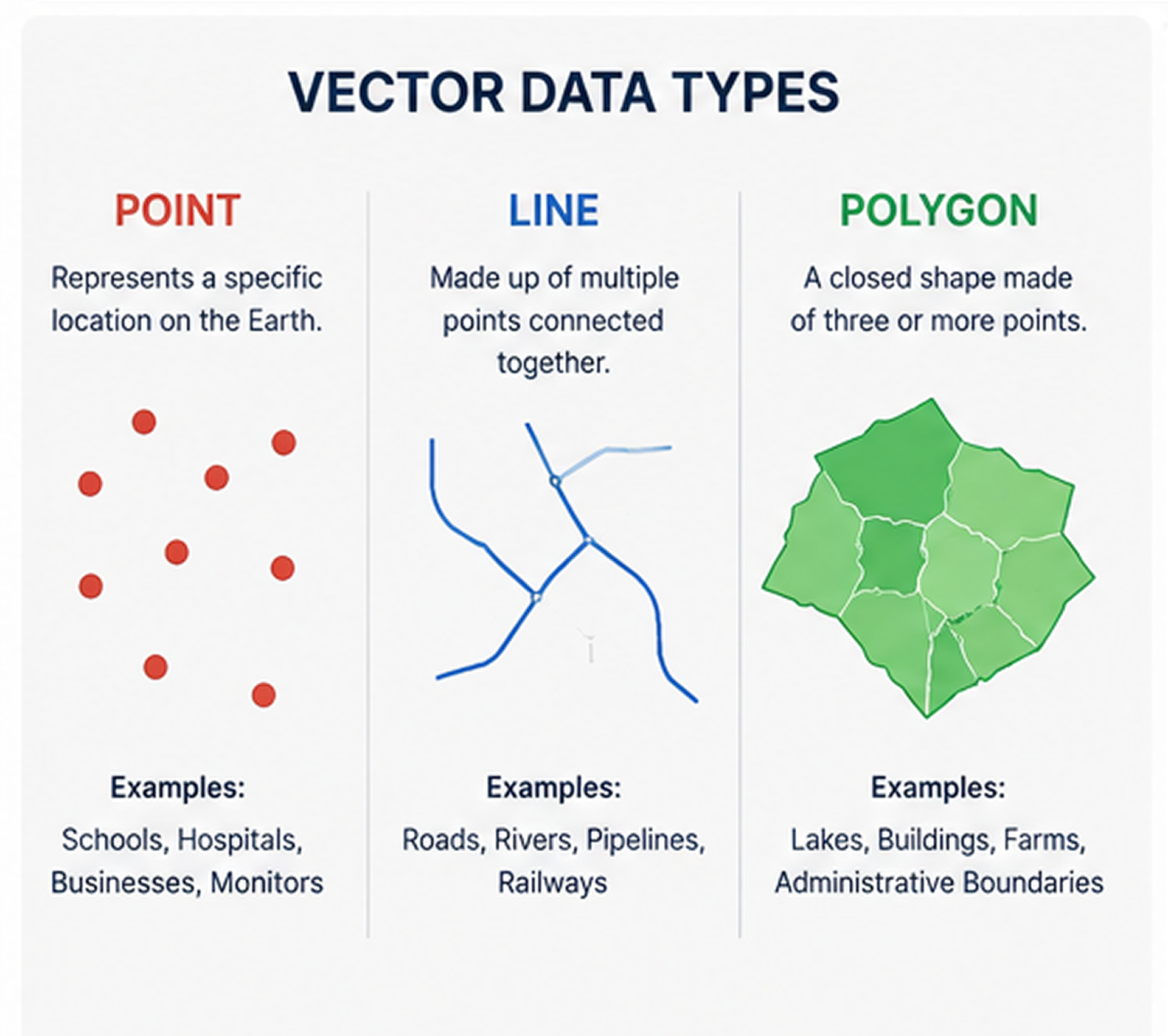
The connections between these vertices determine the type of vector feature:
- Points represent individual locations.
- Lines connect multiple points to represent linear features.
- Polygons connect multiple points to form closed areas.
Vector data retains the precise location and shape of geographic elements, in contrast to raster data, which depicts the world as a grid of pixels. Because of this, it is very accurate for spatial analysis and mapping.
Vector data is used by GIS software for activities including mapping, navigation, infrastructure planning, and object identification.
Types of Vector Data
1. Points
Points represent a single geographic location using one pair of coordinates (x, y). Businesses, schools, hospitals, weather stations, bus stops, and cell towers are a few examples. A point accurately locates an object even though it has no length or area.
2. Lines
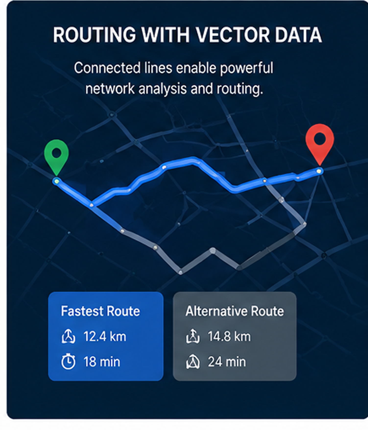
Lines are formed by connecting multiple points. Roads, rivers, railway lines, pipelines, and electricity transmission lines are examples of linear characteristics that are represented by them. Lines are frequently used for network analysis and routing because they preserve connectivity.
3. Polygons
Polygons are created by connecting multiple points into a closed shape.
They represent areas such as building footprints, lakes, parks, agricultural fields and country boundaries. In contrast to points and lines, polygons can store both the boundary of an object and information about everything contained within that area.
For instance, characteristics such as owner, crop kind, acreage, and soil type might be included in a polygon that represents farmland.
Advantages of Vector Data
Detailed Geographic Information
Vector data not only stores the location of features but also captures their relationships and descriptive attributes.
For instance, GIS can identify properties affected by proposed infrastructure projects or pinpoint settlement areas close to geological fault lines.
Accurate Navigation and Network Analysis
Vector data is a major component of many navigation programs.
Road networks represented as connected lines allow routing algorithms to calculate the fastest or shortest path between two locations. Telecommunication companies also use vector networks to determine optimal locations for cell towers and analyse network coverage.
Thematic Mapping
Vector data is ideal for creating thematic maps that communicate specific information.
Examples include:
- Number of hospitals per district
- Population density by county
- Crime rates by neighborhood
- Museums by province
Different symbols or colours might stand for different values in different parts of the world.
Efficient Storage
Vector data stores only the coordinates required to define an object, making it significantly more storage efficient than high-resolution raster datasets.
Powerful Spatial Queries
One of the biggest strengths of vector data is the ability to answer geographic questions such as:
- Which schools are within 2 km of a hospital?
- Which houses are inside a flood-risk zone?
- How much agricultural land exists within a district?
- Which jobs are within walking distance of a transport hub?
These types of spatial queries are widely used in planning and decision-making.
Limitations of Vector Data
Although vector data is extremely powerful, it also has some limitations.
Potential Loss of Detail
Vector data simplifies real-world features into points, lines, and polygons. Highly detailed natural features may lose some complexity compared to raster imagery.
Potential Bias
Many vector datasets are manually created or digitised, meaning their quality depends on the accuracy of the source data and the person creating them.
Computationally Intensive Analysis
Spatial calculations involving multiple vector layers often require complex geometric operations.
Examples include:
- Finding all buildings within a specified radius
- Calculating total agricultural land
- Overlaying administrative boundaries with land-use maps
As datasets grow larger, these operations become more computationally demanding.
Common Vector Data Formats
One of the most widely used vector formats in GIS is the Shapefile (.shp).
A shapefile typically contains:
- Geometry — the spatial features (points, lines, or polygons)
- Attributes — descriptive information about each feature
- Coordinate Reference System (CRS) — defines how coordinates relate to locations on Earth
- Spatial Extent — the combined geographic coverage of all features in the dataset
An important limitation of shapefiles is that each shapefile can contain only one geometry type. A shapefile can contain points, lines or polygons but never a mixture of them.
Other commonly used vector formats include GeoJSON, SpatiaLite, TAB (MapInfo), Geodatabase, ID and MAP
Applications of Vector Data in GIS
Vector data is used across numerous industries and disciplines.
Some common applications include:
Urban Planning
Zoning, land use planning, building management, and city expansion are examples of urban planning applications.
Transportation
Traffic management, route optimisation, public transport planning and road maintenance are examples of transportation applications.
Environmental Monitoring
Examples include Land-use change detection, Protected area management, habitat mapping and conservation planning.
Cadastral Mapping
Property boundaries, land ownership and parcel management and land registration
Utilities and Infrastructure
Water pipelines, Electricity networks, Sewer systems and telecommunications infrastructure
Disaster Management
Flood evacuation routes, Safe zones, Emergency response planning and hazard mapping
Real Estate Analysis
Property valuation, Proximity to schools, hospitals, and shopping centres, accessibility analysis and investment planning
Conclusion
Vector data is one of the most fundamental components of GIS. By representing geographic features as points, lines, and polygons, it enables highly accurate mapping, powerful spatial analysis, and efficient decision-making.
Whether you are planning cities, managing infrastructure, analysing environmental change, or building navigation systems, vector data provides the precision and flexibility needed to model the real world.
In the next post, we will explore how vector and raster data complement each other and when to choose one over the other in GIS projects.