Geospatial Data Explained: Everything You Need to Know
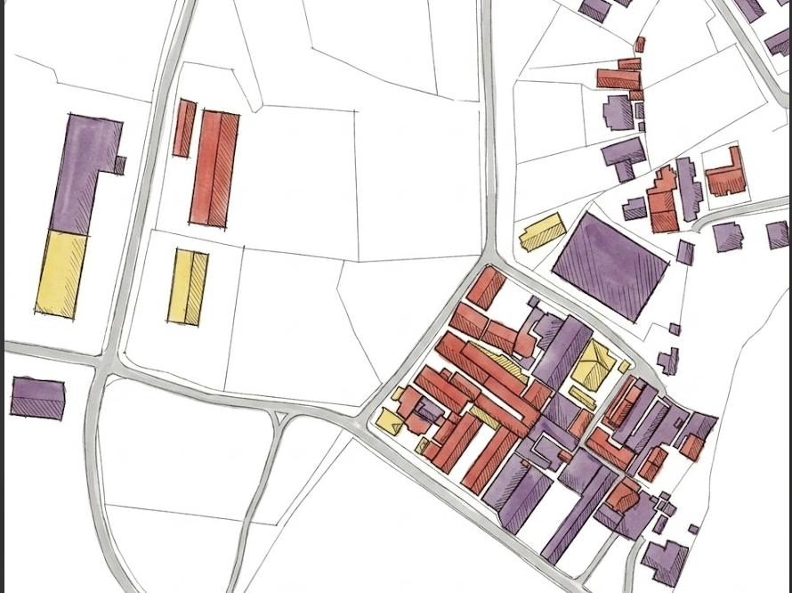 Have you ever wondered how Google Maps knows the fastest route home? Or how satellites monitor deforestation, track floods, or help identify new buildings? Behind all these technologies is geospatial data. Whether you’re using GPS to navigate, ordering food online, tracking a delivery, or analysing satellite imagery with artificial intelligence, you are interacting with geospatial data.
In this article, we will explore what geospatial data is, where it comes from, the different types of geospatial data, and why it plays such an important role across industries today.
What is Geospatial Data?
Geospatial data is information that describes where something is located on Earth and what it is.Every piece of geospatial data has two important components:
- Location – where an object exists.
- Attributes – information describing that object.
For example:
| Location | Attributes |
|---|---|
| Latitude & Longitude | Building name |
| Street Address | Population |
| ZIP Code | Land use |
| City or Country | Construction year |
Some locations are static, meaning they rarely move. Examples include schools, hospitals, roads, and restaurants. Others are dynamic, meaning they change over time. Examples include: Aircraft in flight, marathon runners, delivery vehicles, wildlife migration and the spread of infectious diseases
Adding the dimension of time allows us to study how locations change, making geospatial data even more valuable for analysis and decision-making.
What Makes Up Geospatial Data?
A geospatial dataset generally consists of three components.
- Geographic Features
These are the actual objects being represented, such as roads, rivers, buildings, forests, or lakes.
- Attributes
Attributes provide additional information about those features.
For example, a building might have attributes such as name, height, number of floors, year built and building type.
- Metadata
Metadata describes the dataset itself rather than the geographic features. It typically includes information such as Coordinate Reference System (CRS), projection, datum, units of measurement, date of creation and data source. Without proper metadata, it can be extremely difficult to combine datasets from different sources accurately.
Where Does Geospatial Data Come From?
Geospatial data is collected from many different sources.
Some of the most common include satellite imagery, aerial photography,drones, GPS devices, smartphones, government census data, OpenStreetMap, environmental sensors, surveyors in the field and social media with location tags
Sometimes geospatial data is also created by digitising paper maps or by transforming existing datasets into new formats.
As technology continues to evolve, new sources of geospatial data are being generated every day.
Types of Geospatial Data
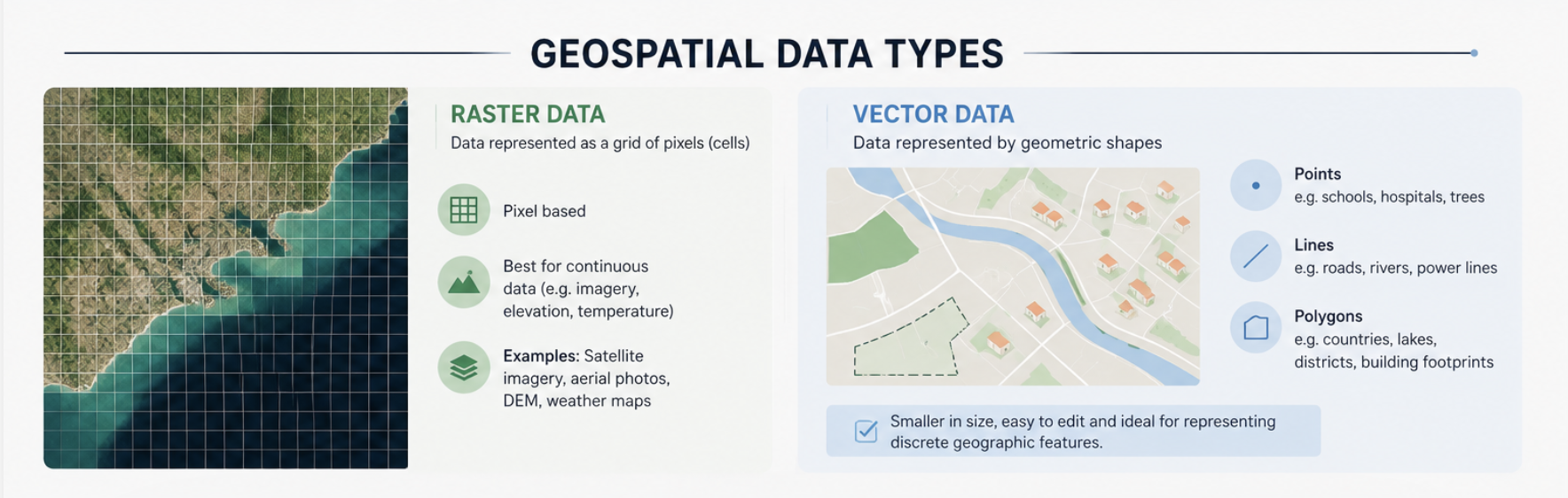
Geospatial data is generally stored in two main formats: Raster data and vector data.
Raster Data
Raster data stores information as a grid of equally sized cells called pixels.
Each pixel contains a value representing information such as colour, temperature, elevation, or vegetation.
Common examples include:
- Satellite imagery
- Aerial photographs
- Digital Elevation Models (DEMs)
- Weather maps
Because raster data stores information for every pixel, it is excellent for representing continuous phenomena but often requires large amounts of storage.
Vector Data
Vector data represents geographic features using geometric shapes.
There are three basic geometry types:
Points used for discrete locations such as schoools, hospitals, trees etc
Lines used for linear features such as roads, rivers, railways and power lines.
Polygons used to represent areas such as countries, lakes, parks and building footprints.
Compared to raster data, vector data usually requires less storage and is easier to edit and analyse within Geographic Information Systems (GIS).
For example, a city map might represent:
- Houses as points
- Roads as lines
- Administrative boundaries as polygons
Applications of Geospatial Data
Whenever location matters, geospatial data becomes valuable. Some common applications include agriculture,urban planning, disaster response, environmental monitoring, public health, telecommunications and transport and logistics.
In recent years, machine learning has greatly expanded what can be achieved with geospatial data. AI models can now automatically detect buildings, roads, flooded regions, forest loss, crop health, illegal mining activities and land cover changes. These technologies are helping governments, researchers, and businesses make faster and more informed decisions.
Related Geospatial Technologies
Several technologies work together within the geospatial ecosystem.
Geographic Information Systems (GIS)
GIS is software used to store, manage, analyse, and visualise spatial data. One of its most powerful capabilities is layering multiple datasets together. For example, roads, rivers, land use, and population density can all be displayed on the same map to uncover patterns that would otherwise be difficult to see.
Global Positioning System (GPS)
GPS provides accurate positioning and navigation using satellites.
Remote Sensing
Remote sensing collects information about Earth’s surface without physical contact, typically using satellites, aircraft, or drones.
Geofencing
Geofencing creates virtual geographic boundaries that trigger actions whenever a device enters or leaves a specific area.
Benefits of Geospatial Data
Organisations across many industries rely on geospatial data because it enables better decisions.
Some key benefits include: better planning, early warning systems and better decision making thanks to the abiltiy to identify trends in the data and predict future trends with accuracy.
Challenges of Geospatial Data
Despite its benefits, working with geospatial data is not always straightforward.
Massive Data Volumes
Modern satellites generate enormous amounts of data every day. Managing, storing, and processing these datasets requires significant computing resources.
Multiple Formats
Geospatial datasets exist in many formats and standards, making integration challenging.
Data Quality
Datasets collected from different organizations may use different projections, resolutions, or coordinate systems. These inconsistencies often require extensive cleaning before analysis.
Specialized Skills
Working with geospatial data often requires knowledge of GIS, remote sensing, coordinate reference systems, and spatial analysis techniques.
Final Thoughts
Geospatial data is becoming one of the most valuable forms of information in the modern world. From navigation and agriculture to disaster response and artificial intelligence, location data is helping solve increasingly complex problems. As satellite imagery, drones, sensors, and machine learning continue to advance, the importance of geospatial data will only continue to grow. Whether you are a developer, data scientist, GIS analyst, or simply curious about how digital maps work, understanding geospatial data is an excellent place to begin your geospatial journey.
References
What is geospatial data and how is it used?
Geospatial Data Types: 9 Key GIS Data Types, Examples & Formats